Advanced Technology Solutions
for Land Development
Land Development Project Solutions
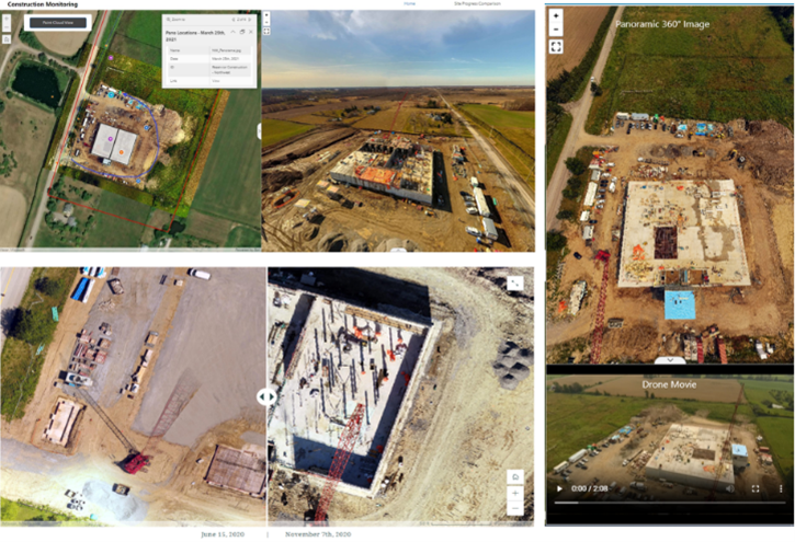
With the complexity and timelines of todays land development projects, the need to monitor construction and progress to ensure projects stay on track is high. With access to the latest geospatial technologies, GeoVerra provides land development clients solutions to do just that. Working closely with several partners in the land development industry, GeoVerra provides innovative solutions that accurately monitor project construction activities and provide virtual tours so clients can see progress week after week. Not to mention, the progress information and virtual tour can be shared with all client stakeholders as needed.

Solving Land Development Challenges
Congested worksites with multiple subcontractors can be a challenge to navigate safely, and continuing demand for new housing push developments to increasingly larger scales. Both problems are easily solved by leveraging GeoVerra’s robust UAV fleet to keep more workers out of harm’s way, and cover large developments in a single mission, capturing a snapshot of the entire project at a single point in time.
Given timelines, safety and complexities of land development projects, traditional solutions for access to detailed and documented progress isn’t the always the safest and most efficient. To combat this, having the technology that allows for detailed documentation of the construction progress, that can be easily accessed remotely by all stakeholders in an efficient manner is essential.

Material balances, take off quantities, progress monitoring and quality analysis are easily performed on these datasets. They require no site revisits to collect additional information, down to the individual stockpile or location of a single manhole.
UAVs equipped with thermal or multispectral cameras are valuable tools for land development projects. A key application is site assessment and planning. By identifying variations in surface temperatures, UAVs can reveal differences in soil composition, moisture levels, water bodies, vegetation health, and wildlife habitats. They can also detect heat signatures from underground utilities. During construction, thermal data can help identify issues such as uneven concrete curing, water infiltration, or insulation flaws.

Why GeoVerra – Trusted, Responsive, Reliable Solutions
GeoVerra is Canada’s largest geomatics firms that embraces technology innovations to advance clients in a data driven world. For land development projects, GeoVerra uses the latest UAV solutions and custom portal technologies to save clients time and give them efficient, consistent, high-quality deliverables. Having access to industry leading technology would mean nothing without their team of experts who are strategically located across Canada and have the capacity and availability to fly drones to meet client schedule demands for a variety of construction and land development projects.
Primary Services
- Volume calculations
- Quantity and measurement solutions
- Web portals
- UAV imaging
- UAV Solutions (LiDAR, thermal, multispectral)

Deliverables
- Custom online portals to access updated time-lapse of project activity
- Stakeholder access to online web-portal
- Quick-turnaround data
- High resolution and accurate images
- Volumes, material balance and takeoff quantities
Outcome
Collecting data with UAV solutions that are uploaded to an interactive online portal gives clients access to share information easily with shareholders in a safer and more cost-effective option in comparison to in-person visits. GeoVerra’s capacity and availability provides land development clients with the tools to plan more effectively, measure the progress of their project and budget for future activities.
Routine flights of land development projects allow our clients to keep their fingers on the pulse of their project, regardless of where they are located, and our interactive online portals remove the need for specialized software or training, empowering all levels of the project team to get the information they need, when they need it.
– Andrew Hill, GeoVerra Project Coordinator, LSIT
For more information on how the GeoVerra team can support your powerline project, send us a note at www.geoverra.com/contact

Ready to Start?
As one of Canada’s largest geomatics companies, we have field offices dotted from British Columbia to Ontario so that we can deploy teams with local knowledge at the drop of a hat and scale quickly to meet project needs.